Tackling the 75km West Coast Trail

I slipped my feet into the white sand. Its cool composure liberated me from the throbbing pain. I was too exhausted to jump into the ocean and wash out all the dirt on my face and my hands, and the sweat that has accumulated on my skin and my clothing. I laid there for a couple of hours, soaking in the warmth of the sun, the breeze of the sea, and the sand between my toes, thinking about nothing but: I did it!

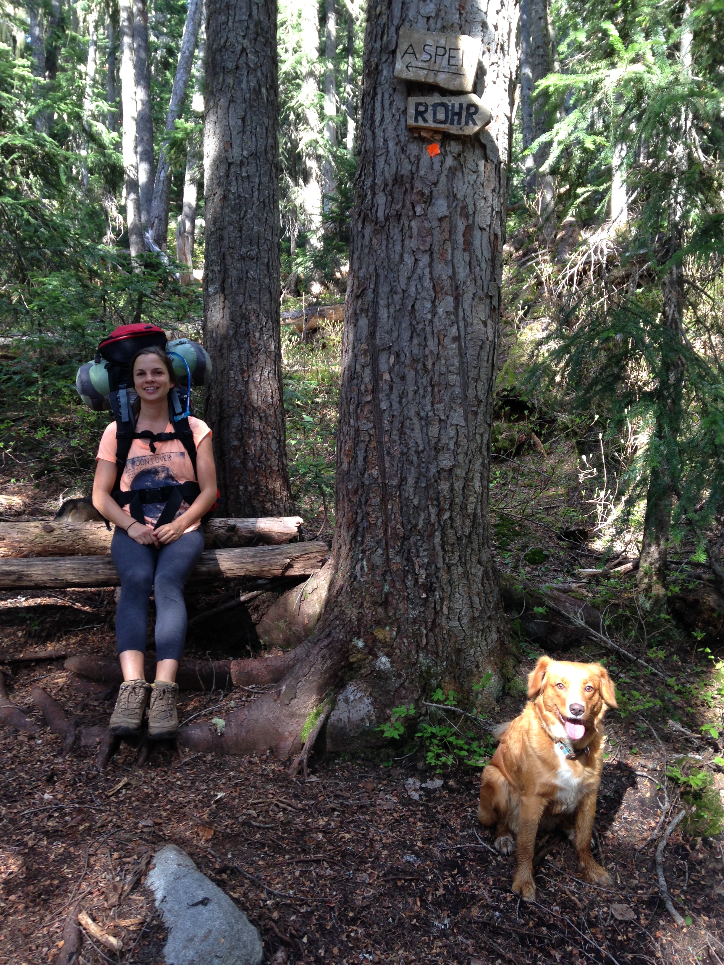
Seven days ago, my girlfriend and I had packed our backpacks with everything we needed to survive for a week: camping gear, hiking clothes, dehydrated food, and survival kit. We had planned this trip for a few weeks and were anxious to finally begin. The West Coast Trail has always fascinated me. I’ve heard about it from fellow adventurers I’d met along my travels, and it seemed like the kind of adventure I had to put on my bucket list. I am no expert hiker, although I have several trips under my belt. The Pacific Northwest has been my backyard for over a decade now, offering many trails to wander, glacier-fed lakes to discover and mountain peaks to conquer. I have also hiked around Kathmandu, Nepal, staying in tea houses, eating home-cooked meals and carrying a small backpack. But the WCT was the kind of adventure I’ve never done before. It was a physical and mental challenge far beyond anything I’ve done. It was much more than just a stroll in the woods.

The West Coast Trail is a gruelling 75km long backpacking trail hugging the southwestern edge of Vancouver Island in British Columbia, Canada. Construction of the trail debuted in 1889, originally part of a communication system connecting the British Empire in North America by an undersea cable which ran all the way to India. After the wreck of the Valencia in 1906, the trail was improved to facilitate the rescue of shipwrecked survivors along the coast. It is now part of Pacific National Rim and is known as one of the world’s top hiking trails.

Day 1: Embrace the opportunity
Gordon River to Trasher Cove- 6km

Butch took us to the trailhead across the Gordon river with his fishing boat. We jumped off the craft onto the sand, only to be welcomed by a 52 rung vertical climb ladder. Welcome to the WCT!

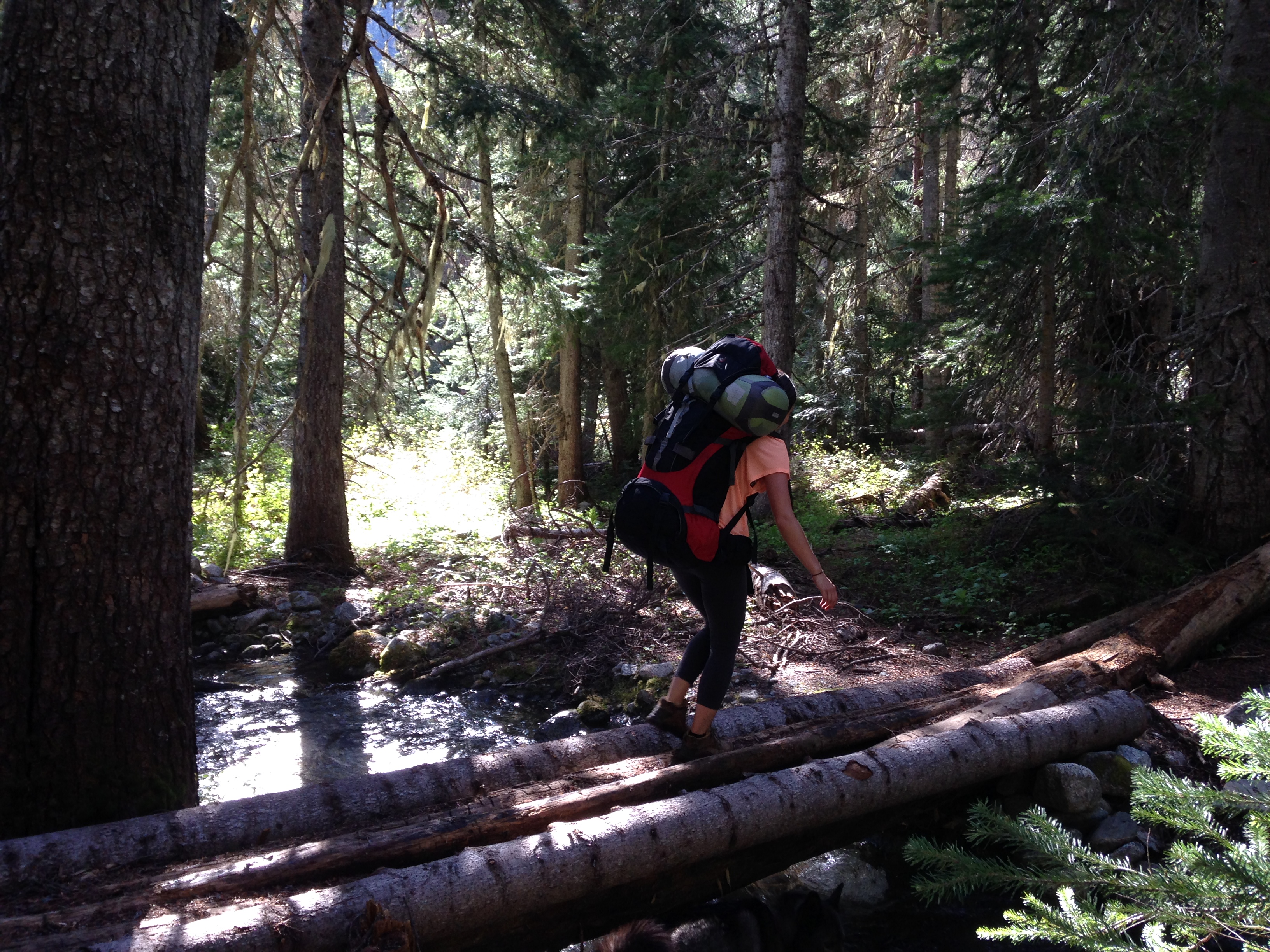
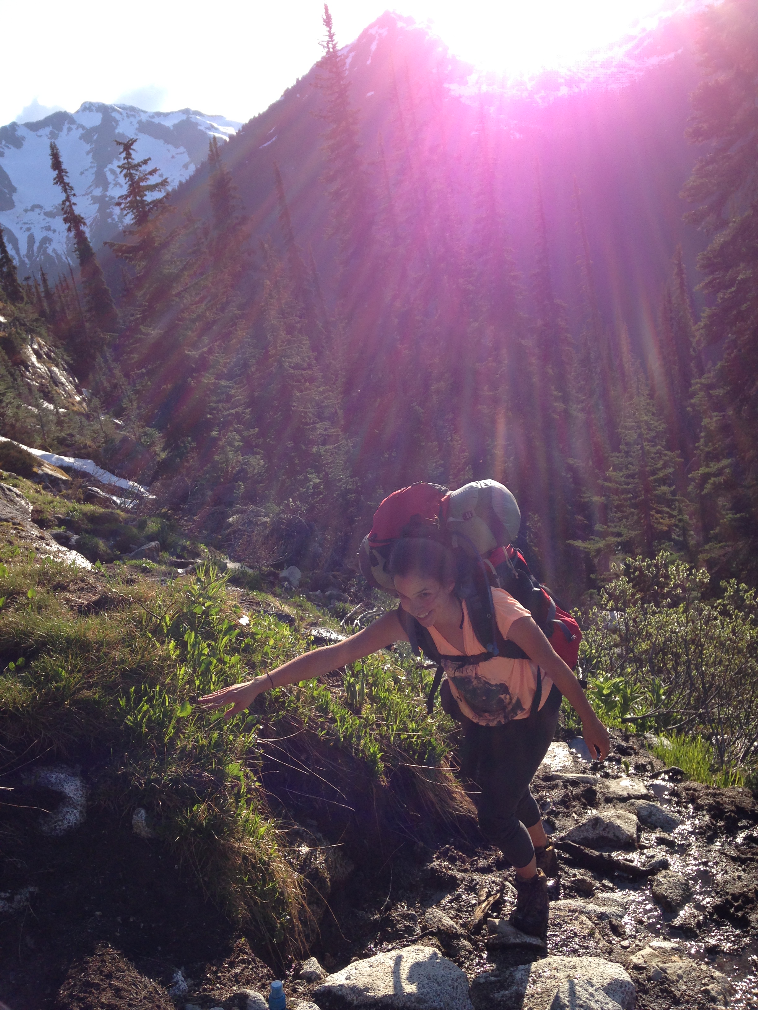
My bag was heavy. It pulled my shoulders and the strap on my chest pushed my lungs making it hard to breathe. It wasn’t that the trail itself was hard, but rather acclimatizing to my gear. My 43 pound bag carried all I needed for surviving a week in wilderness. I did read it shouldn’t be more than 30% of my weight, yet bringing a deck of cards, a reading book, tank tops and too much food seemed to be essential and weightless at first glance. I regretted my amateur decision of bringing the unnecessary every step I took, carrying a bag nearly half my weight, turning into a turtle camouflaged by her shell. It was a slow march through the woods, travelling 1km an hour.

As I hiked I pondered what drew me into doing this trail. It wasn’t solely for the remote beauty of the coastline, the impressive old growth forests and the endless empty beaches. I wanted to test my capabilities, to see how far I could go physically and mentally. I was attracted to the sheer challenge, to the experience, to the accomplishment, to the opportunity to learn and to grow.

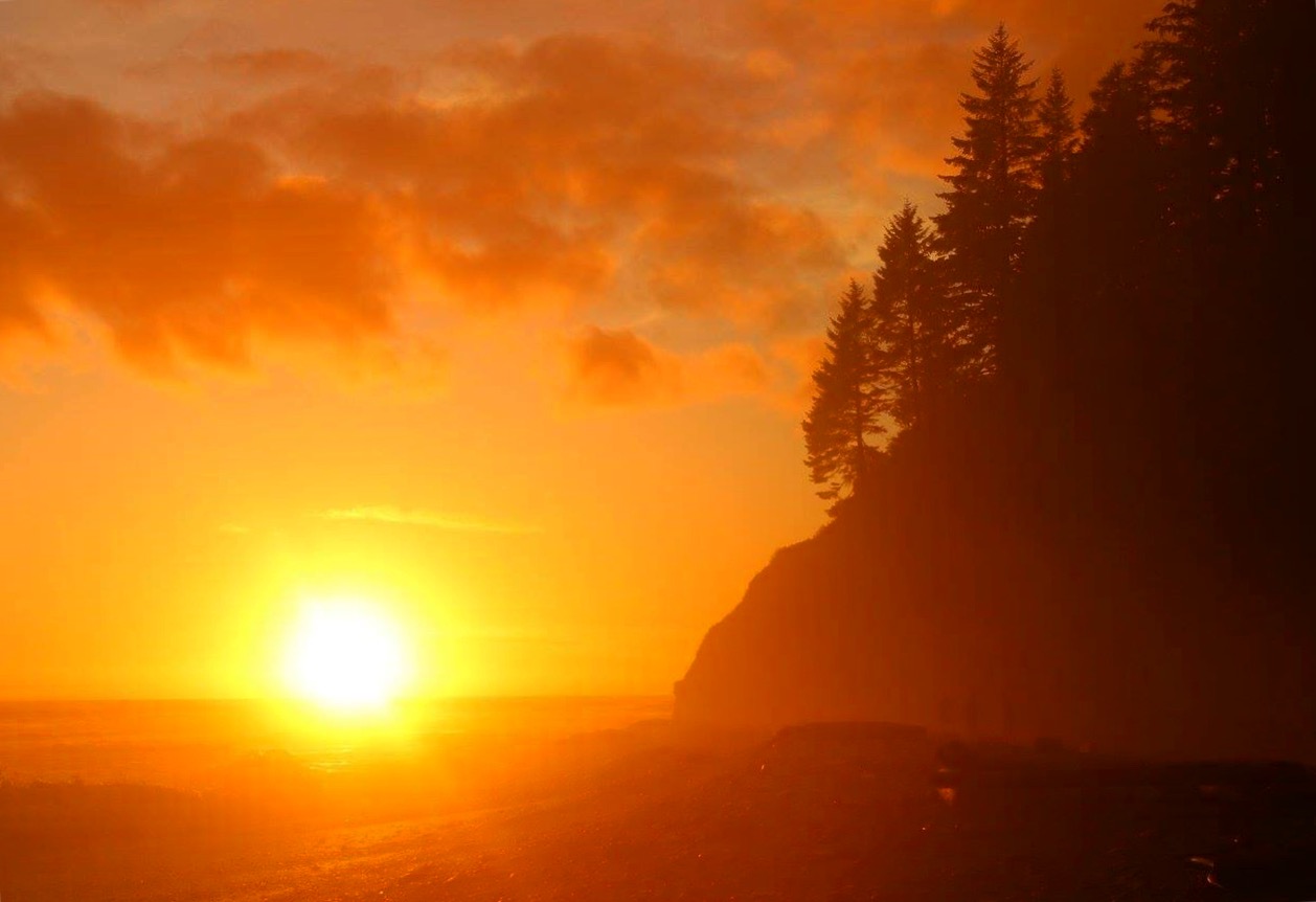
When we got to Trasher Cove, we set up camp on the beach, and watched the sun disappear behind the trees, leaving an orange glow over the ocean. As the sun dimmed its light, we called it a night.

img_7841

Day 2: Slow down
Trasher Cove to Camper Bay- 8km

The sunrise was sublime. The sky was clear and the breeze was invigorating. We started the day on the beach at low tide, hiking on black stone shelves, careful about wet surfaces. This part was so beautiful, and pretty enjoyable to trek. We walked through a cave and arrived at Owen Point where a group of sea lions sun bathed on a rock erected from the ocean.

We hopped from boulder to boulder, jumped over crevasses, traversed the edge of a gully holding on a slippery rope.

The magnificence of the views muted me. I was in awe taking in impressive images of the vistas. We took our time, slowing down to admire the incredible landscape.

When the tide rose up, we entered the forest and finished the trek inland. It was muddy, extremely muddy, and we had to be very smart about each step. This very technical day ended up at Camper Bay, where we arrived in our first cable car.

As the sun shied away behind the clouds, we gathered around the campfire with fellow hikers, discussing of food and gear, and sharing stories of the trail and of home.

We retired early to our tent, away from the beach and sheltered in the trees. Then the rain began.

img_6804

Day 3: Love the journey
Camper Bay to Walbran- 9km

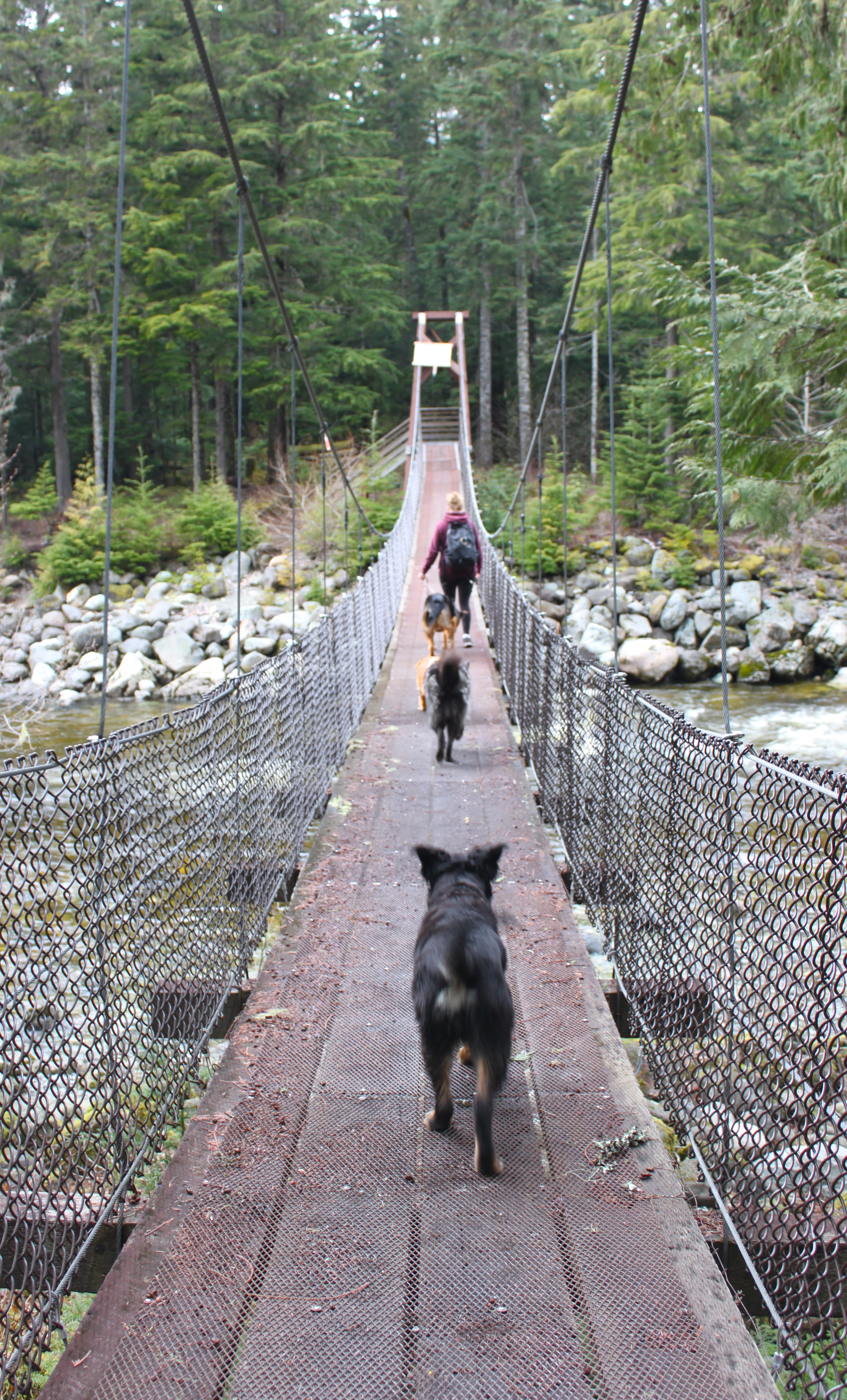
It poured all night, and it wasn’t ready to stop. We broke camp, put on our monster backpacks and headed back on the trail as the heavy rain lashed. The course was challenging and we got to test our skills and our sense of humour on slippery logs, impassable headlands, uncountable ladders, broken boardwalks, thick patches of deep mud, suspended bridges and one more cable car.

It wouldn’t have been the WCT if it wasn’t for the wet weather, the rugged terrain, the remoteness of the trail. I was soaked, dirty, sweaty, yet I couldn’t be more happy to walk this incredible journey.

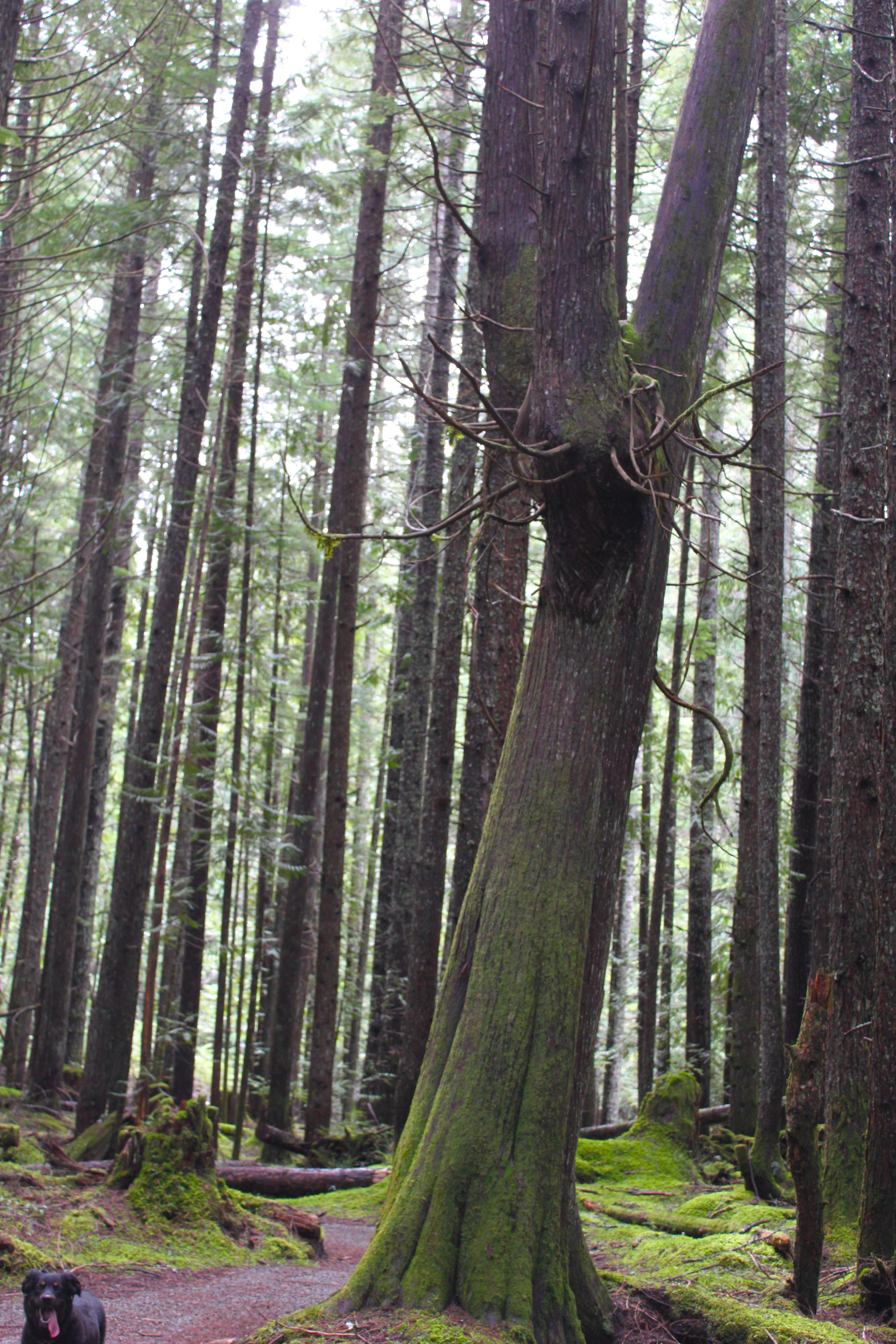
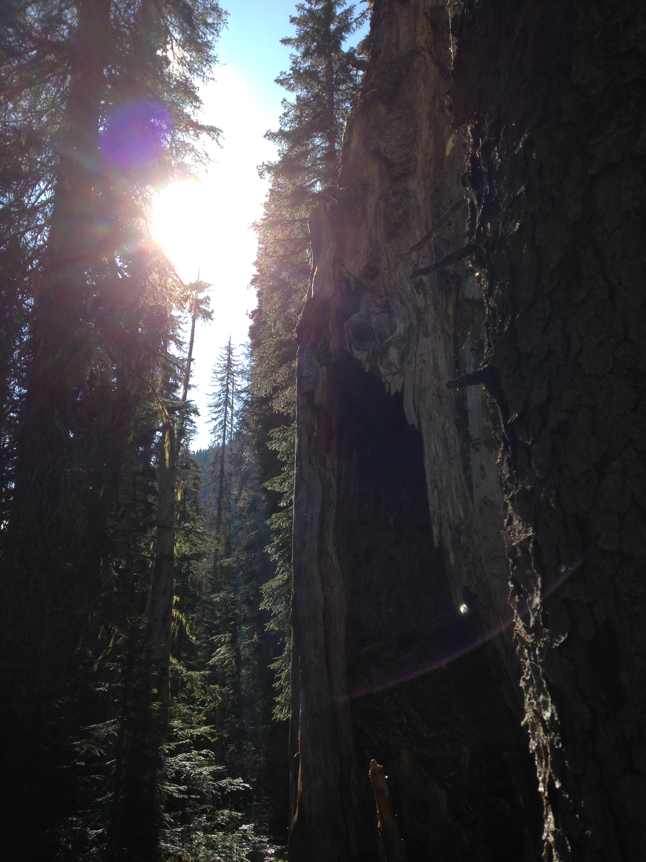
As we reached our couple last kms, the sun slowly penetrated the clouds. The forest canopy stood high above me as the sun rays filtered through old growth trees. I fell in love with the lonesome beauty of nature. It was raw, it was pure, it was terrifyingly beautiful.

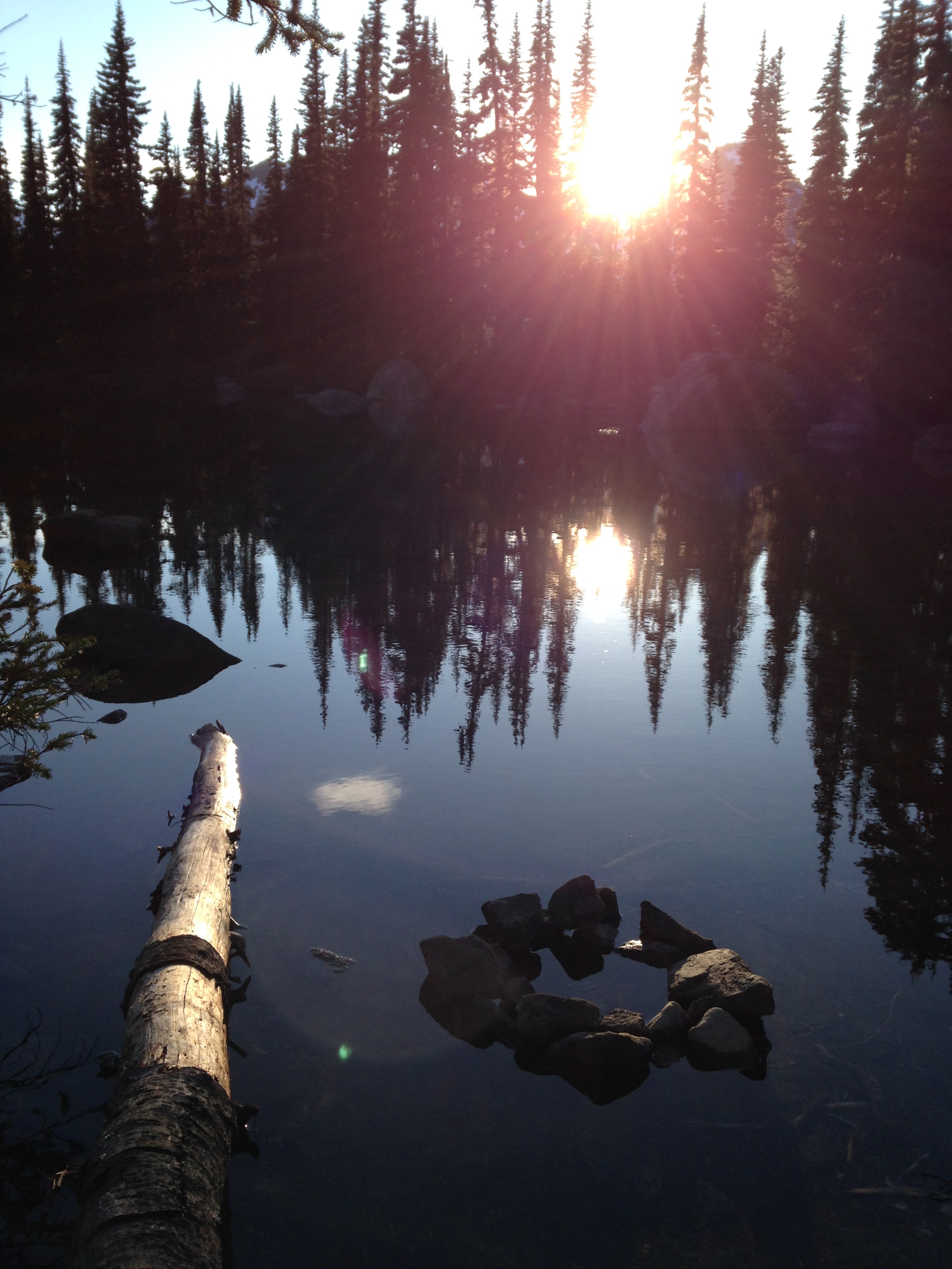
The trail opened up to the creek, that ran into the ocean. We walked through the fog, shuffling our tired and wet feet in the sand. Campers setting up their tent, warming up by a fire, and collecting water greeted us with a smile. It felt like a parallel universe, being alone all day in the wilderness and arriving to a place temporarily inhabited by humans. I grabbed my flask of maple whisky from my bag, and took off my shoes. I didn’t want to start a fire, set up the tent, get fresh water nor cook dinner. I wanted to admire that well-deserved sunset.

img_7931

Day 4: Things aren’t always like planned, and it’s okay
Walbran to Cribbs Creek- 11km

The morning light seeped into the tent. I forced my feet back into my wet socks and boots, and strapped my loaded bag on my back. Our plan was to hike on the beach, but the creek was too high to cross that early. We changed our plan and headed inland, after crossing our third cable car.

It reminded me how in life things don’t always go as planned, and it’s okay. Sometimes we have to change our route or take a detour, but that doesn’t mean we’re not on track.

We arrived at Cribs Creek where I immediately removed my wet gear. I skipped dinner, still full from my decadent $22 cheeseburger I had at Chez Moniques’, a 77-year-old lady who opened up a burger shack in the middle of the trail on reserve land. I was exhausted and chilled to the bones, so after setting camp I crawled in the tent, zipped myself into my sleeping bag, and let my head sink into my pillow.

img_5445

Day 5: Keep going forward
Cribs Creek to Tsutsiat Falls- 16km

It felt like a never ending story. My bag seemed heavier than the first day, carrying wet and sandy gear. It was a constant effort to stay upwright. I longed for nothing more than water and to take my pack off my shoulders.

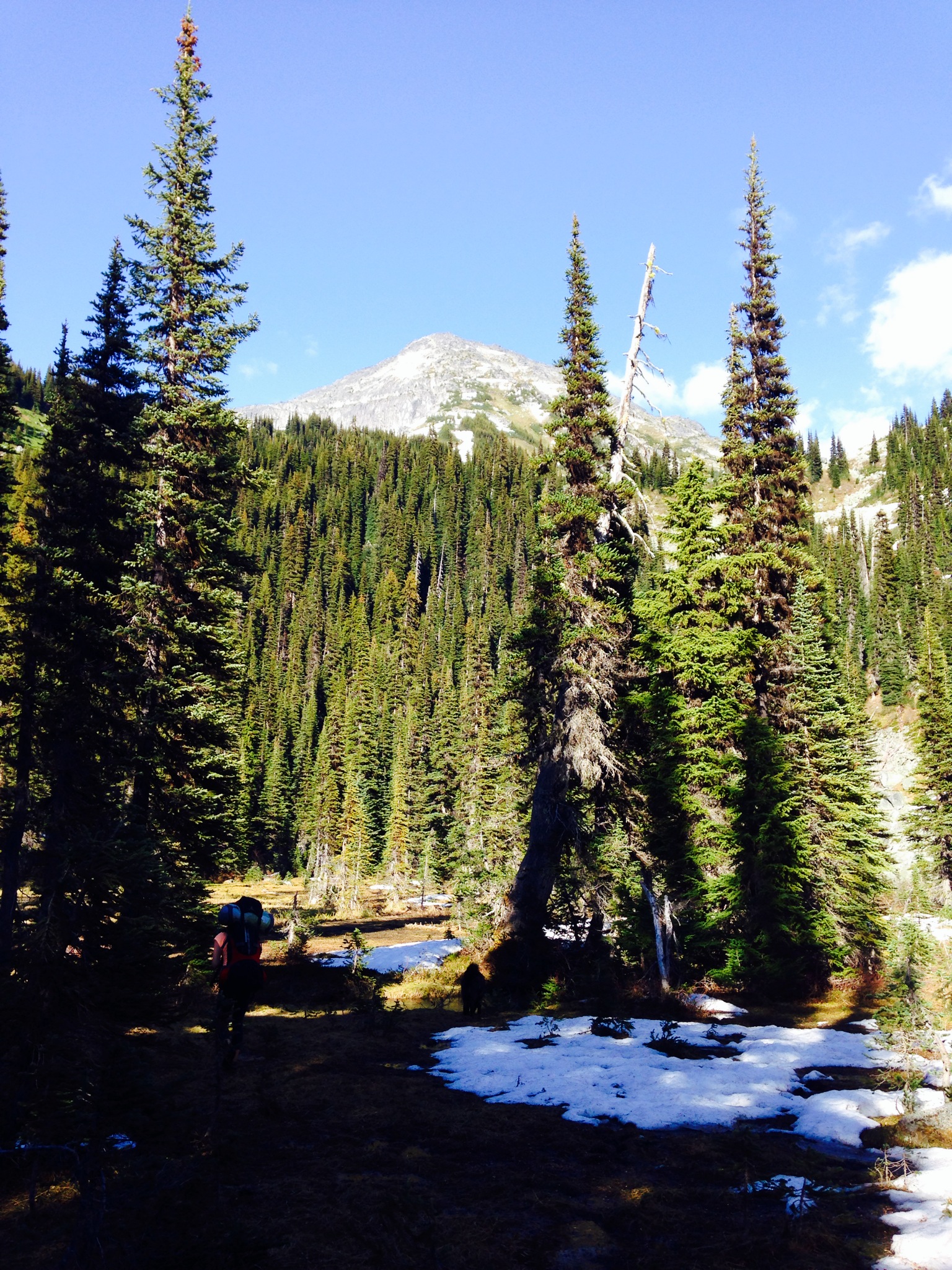
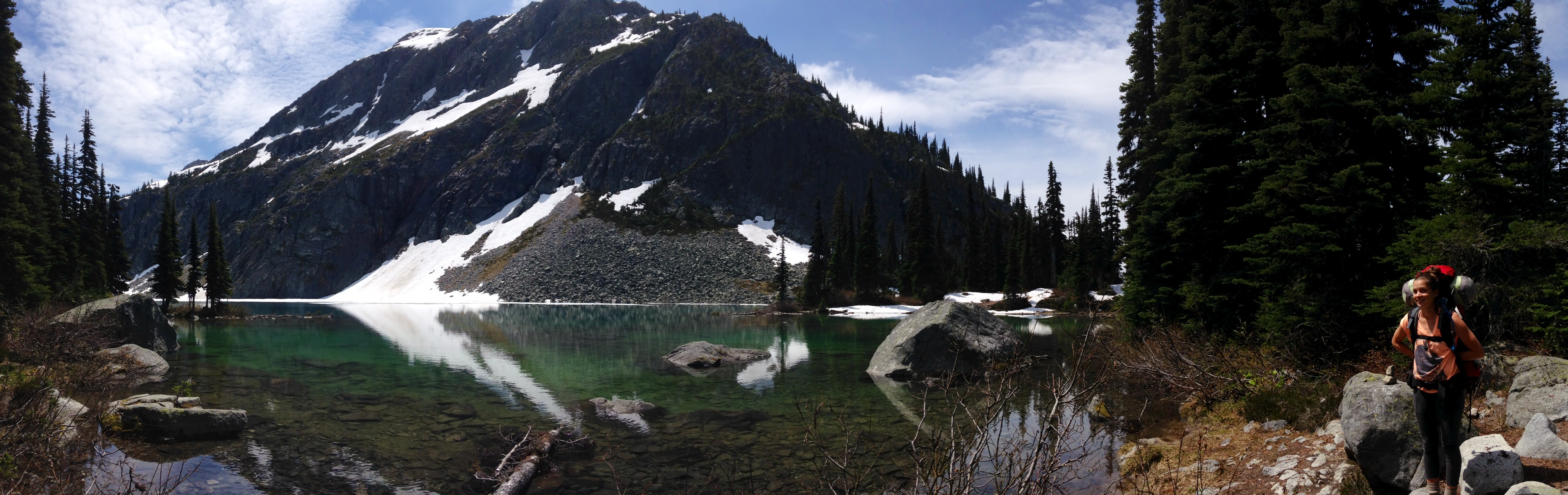
It was a slow progress, stepping one foot in front of another, carefully watching every movement, every step.  My eyes focused on the slippery roots, the sinking mud holes, the loose sidewalk. It became so technical I’d forget to look up. I had to stop, not only to rest my back from the load, but to admire the scenery. I stood in a world of infinite, pure and quiet beauty.

I’d take a deep breath, taking in all the fresh air and the beautiful images. Somehow it gave me energy to pursue. As it reminded me why I was there on this trail, how going forward was the only way to see more, to know more, to live more.

The last couple of hours were brutal. My body was about to collapse in the loose sand, my hair sticking to my face, my provision of water rapidly diminishing. I knew I had to keep going forward, because going back to where I started wasn’t an option. So I put one foot in front of the other, over and over again, because at least I was going somewhere. And I was going to make it.

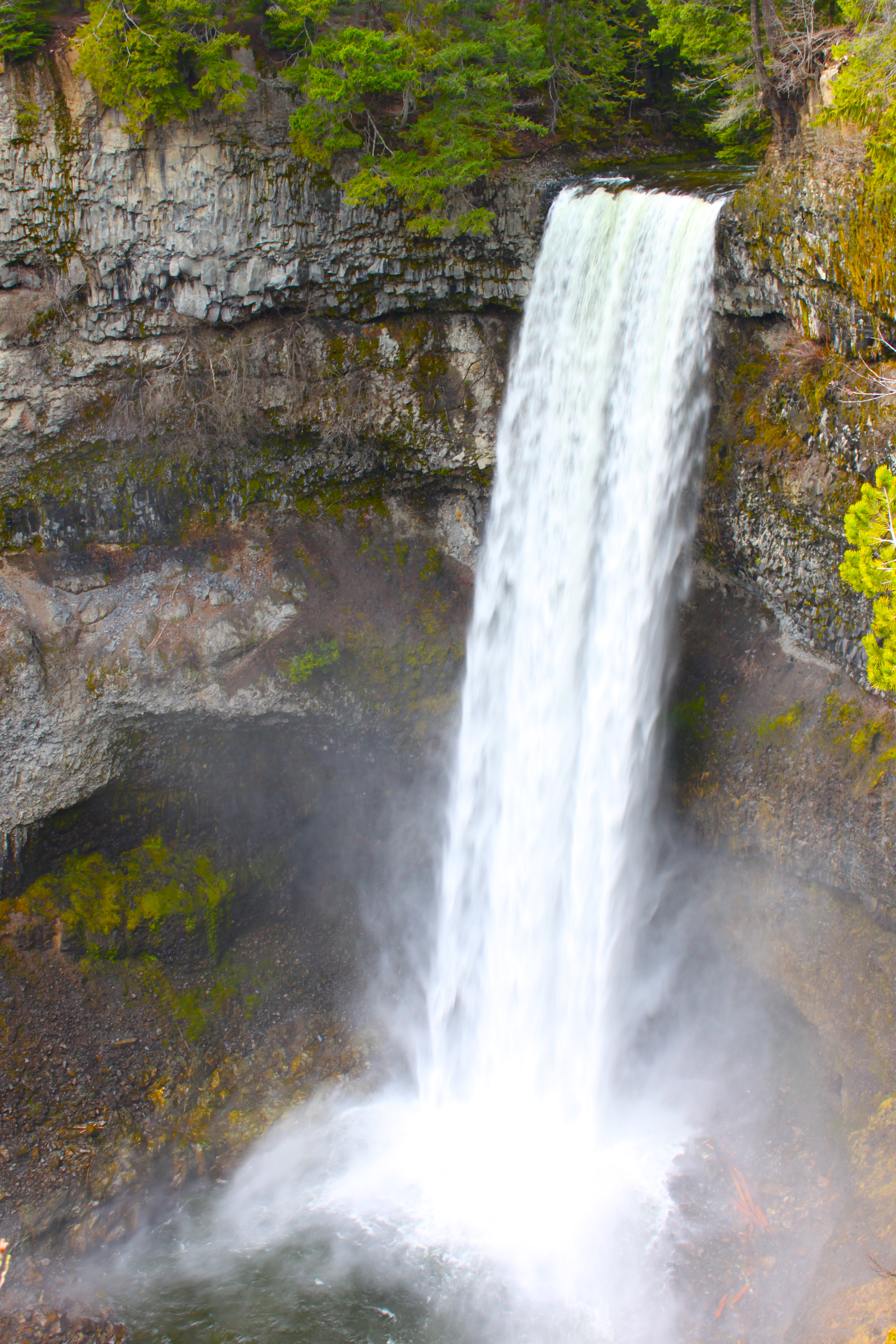
I was drained, in pain and on the verge of collapsing when we arrived to the falls, but I was also over joyed and astonished of how far I’d gone.

img_1534

Day 6: Appreciate the details in each moment
Tsutsiat Falls to Darling Creek- 12km

We woke up to the roar of plunging waves. We admired the falls rushing their fresh water into the ocean bed. The birds songs travelling through my head overpowered the pain on my body. I was ready for another day.

We started off with a series of climbing ladders. I’m not sure if I got used to them, but I didn’t mind them. I had a couple days left on the trail and I was going to win. The clouds rolled in but it never rained. The overcast weather was ideal. There were some really nice stretches in the forest, and cliffside paths, with the ocean appearing in occasional views. I had to pause to appreciate the precious details of my surroundings. It was the lush greens of the trees, the water dripping from the tip of the branches, the sun filtering its timid rays through the fog, the sea foam caressing the sand…

It made me realize that since I’ve been on the trail, my mind never wandered like it does back home. I was so focused on each moment, on each step, free of appreciating the perfection of every circumstances. My mind wasn’t trapped in the past or the future. I was right there, in the reality of the moment, precisely where I was supposed to be.

When we arrived to Darling Creek, we found ourselves completely alone in wilderness. Hikers kept going further on to the next camp. We decided to stay, and enjoyed the whole beach to ourselves. We finally managed to have a raging bonfire, dry our clothes and boots, carved our names on a buoy and share our highlights of our trip, while sipping on the last drops of our whisky and savouring the ice cider I kept for our last night.

The sun came out for a last show of setting light and glow.

img_4809

Day 7: Push your limits
Darling Creek to Pachena Bay- 14km

We rose up to a moon crescent and a starry sky. It was 4am and we had a big day ahead of us. We couldn’t miss our shuttle in Pachena Bay back to Gordon River, and considering our slow pace, we had to have an early start. We poured the Bailey’s we kept for that morning into our coffees. I don’t know if it was the caffeine I didn’t have in a week, or the small dose of alcohol in my body, or a sudden boost of stamina on my last day, but I felt awake and energized. I knew I had to push myself even more today than the others. I had to, and I would. I was committed to accomplish this hike with bliss.

The first couple of kms were on the pebbled beach. We arrived at the other camp where everybody were still snoozing. We tiptoed through the tents and took the trail inland, making our way through the forest in the darkness of dusk.

This last stretch was the easiest of the whole trail, and we crunched distance like superheroes. I didn’t let my back, nor my blisters, nor my aching knee, nor my exhaustion discourage me. I was in such a mindset to push and keep going that I couldn’t feel anything anymore but my mind taking over my body. I was in a state I haven’t been in while, pushing myself well beyond what I thought were my limitations. I became numb to my pain, and felt the exhaustive exhilaration of pushing myself to my limits, with a burning desire to make it to the end.

We travelled 14km in less than 3 hours. And then there it was, the end. We have arrived.

We did it.

We signed off and unloaded our packs from our backs. We took off our shoes and our gaiters. We were the first ones of the day to complete the hike, and we had 4 hours before our shuttle. So we took the trail that headed to the white sand beach.

img_8091

Humbled and blissed

The coastal trail had humbled me. I was brought into the flow of life, embracing the immense beauty and magic of each moment. I had pushed myself further that I’ve gone before, and discovered a strength within that assured me that I could achieve anything I set my mind to.

The WCT reminded me the importance of setting ourselves goals, pushing ourselves out of our comfort zone, challenging ourselves to take one more step, running when we can’t walk anymore. By physically and mentally pushing ourselves, we discover that pain and exhaustion lead to incredible feelings of joy and success.

Life is about choosing our own path, taking risks, embracing uncertainty, taking the unpredictable turn, falling down, getting up, and never giving up when the road gets tough. We are stronger and greater than we think, and are capable of anything we set ourselves for. As long as we keep moving forward. As long as we have the right mindset and are not afraid to cross the creek and get wet.

A Sunday Stroll

Life on the road is absolutely exhilarating. But you can’t always be trotting from country to country eternally. You eventually have to go back home to recharge the battery and you soon fall back into routine. You feel trapped in normality and daydream of your next destination. But until you set sails and explore the whole wide world again, you have to remember that you also live in a place that is worth discovering and spending time in.

As my home base, I chose Whistler, a Canadian resort town located in the southern Pacific Ranges of the Coast Mountains of British Columbia. Living here is an outdoor lovers’ dream. Not only is Whistler known as one of the best skiiing destinations in the world, but it also offers many great lakes to fish, challenging mountains to hike, stunning waterfalls to photograph, wilderness grounds to camp, trails to run, hike and bike. The senses are pleased everyday with nature and it is a place of endless adventures.

This Sunday, my friend Cori and I planned a leisure walk to Brandywine Falls. This provincial park is situated south of Whistler in the Sea-to-Sky Corridor. There is access to the waterfalls from the parking lot, involving an easy and short walk. But ‘easy’ isn’t how we like to spend our Sundays, so we decided to begin our excursion in Whistler and walk the Sea-to-Sky Trail, just to spice things up a notch. The Sea-to-Sky Trail is a 180km wide dirt and gravel trail starting in Squamish and stretching all the way up to D’Arcy. It is great for biking and hiking, and offers scenic sights all along the way. photo 1-8 We parked in the southern portion of Whistler, Function Junction, and accessed the trail from the road. Along with our 4 furry canine companions, we began our excursion. IMG_6172   The sun filtered its soft light through the massive Douglas-Firs and Western Red Cedars and glittered with dew resting on their branches. We embraced the essence of nature as we meandered through the beautiful coastal forest. IMG_6177 We crossed a couple of suspended bridges overlapping the Cheakamus River. We watched the crashing water flowing aggressively underneath our feet. IMG_6180 As we approached our destination, strolling through a pine forest and lava beds, we could hear the roaring sounds of the water amplifying. When we arrived to the platform viewpoint, we admired the 66m waterfall thundering down the valley below. We cracked our bottle of bubbles and contemplated the water gushing from the abrupt cliff and the impressive gorge holding such a spectacle. IMG_6181 As the rain peaked out of the clouds and cooled off our heating bodies, we packed our bags and headed back. We were sheltered by the thick trees standing strong and high and we ascended the winding trail. IMG_6178 Our legs were burning and our conversations fading. Everytime we slowed the pace, all dogs rested in the moss, tongue out and reaching for air. IMG_6176 We arrived at the car at dusk, soaked and muddy, with the greatest smile of satisfaction. Our leisure walk ended up being a 25km adventure hike. This excursion reminded me how fortunate I am to be living in a place of such natural beauties.

DCIM100GOPRO

You don’t always need to fly to satisfy your wanderlust. Whether you live in a city, on a coastal town or in the mountains, your home has hidden gems ready to be discovered. You can apply the spirit of travel at home, by simply being mindful and aware of what is around you. Open yourself to your surroundings, be curious, and have an adventurous mind. By appreciating the little things, and embracing the challenges, you become part of the beauty. And that’s the most wonderful adventure of all!


Rohr Lake – Cayoosh Range, BC

Camping has always been an important part of my life. Since I moved to the west coast in 2003, I camp almost every weekend from late spring to early autumn. In the winter, I camp in the cabins of the backcountry. I don’t mind cold temperatures and am not scared of the wild. In fact, I always put up my tent in the wilderness, places where no one goes, and probably no one’s been. Camping is for me a way of disconnecting from the hustling of my everyday life, reconnecting with myself and finding healing through nature. In fact, for me, there is nothing like the feeling of the mothering power from the earth under my bare feet, the cleansing of my lungs from the pure air, the soothing sound of nature in my ears, and the eye candy images of the natural beauty surrounding me.

I have done truck, boat, canoe, and snowmobile camping. However, I have never camped by foot. I have done a lot of day hikes. However, I have always come back at dusk thinking how great would it be to sleep here under the stars. When I called my outdoorsy friend Claudel and explained her my plan, she jumped aboard instantly.

Most of the hiking trails here in the Sea to Sky are part of Provincial Parks or are watershed areas. Both owners of active dogs, we had to find a trail that allowed our furry friends to happily run wild and free. After a long research, I found Rohr Lake.

Rohr Lake is situated in the Cayoosh Range, on an alpine bench north east of Mt Rohr. The trail is a 15km round trip, for beginner/advanced hikers. I had never heard of it, neither Claudel. There wasn’t much information on the Internet or in the trailmap book, only a few blogs from people that attempted the trail. Perfect, we thought, an unknown and uncrowded trail, exactly up our alley!

We each packed a travel backpack with warm and light clothes, hiking shoes and flip-flops. We had one tent, a chicken salad, a homemade guacamole and corn chips, 2 panini sandwiches, a bunch of grapes and a few energy bars. Claudel brought her sleeping bag and mattress. I went commando on that. I had to leave room for the wine (2 bottles of red, and a sparkling for the mimosas in the morning. Oh and a 6-pack of ciders). Water, dog food, flashlights, whistles, lighters, tissues, cups, cutlery… Our bags were probably half our weight.

It was the last day of spring, on a beautiful and sunny late morning in June. We drove north on Highway 99 to Mt Currie towards Lillooet, on the Duffy Rd. When we passed Joffre Lakes and crossed the first bridge, we turned left onto an unassigned logging road.

photo 1-5

photo 2-6

We drove as far as our car could go, and parked on the side of the trail. If you have a 4WD, you can probably access the trailhead. 

photo 1-3

We walked the rest of the road to the beginning of the trail. It wasn’t much later than 15 min of walking on an easy surface that I thought to myself: Maybe Claudel was right, we could have brought just one bottle of wine…

photo 5-3

The first few km were quite lovely. It was a very easy hike through a well marked forest trail. At times we hopped on rocks to cross streams, at other times traversed stomps over creeks.

photo-5

photo 2-3

After a steep path, we arrived at the intersection of Aspen and Rohr Lake, where we stopped to catch our breath.

photo 5-1

After a confusion in directions, having to drop our bags down on the ground and search for the trail, we found our way and got back on track. The soil was muddy and slippery, wet and snowy. Yet, we were still pretty clean. We made our way to the alpine meadow, where a blanket of moss appeared under the melting snow.

photo-6

There was so much snow still that no trail was to be seen. On our right side, there was a rock facade where the stream came down. We knew there was going to be an abrupt 300m uphill, and there it had to be. We left the bags on the grass and climbed the rocks. Miraculously, I spotted a red little flag attached to a tree, flowing in the wind. We scrambled back down the rocks, and picked up our loads.

This wasn’t easy. As much as I could freely jump from rock to rock without my bag, now with 50 pounds glued to my back, I felt unbalanced with a lack of dexterity.

“So this is what it is to hike with an alcoholic!” mocked Claudel, with a winking smile, while climbing the wall with both hands and feet.

Indeed, the fermented juice we both carried made the hike most challenging. Yet, so rewarding!

photo 2-1

After climbing the steep hill, reaching for rocks through the stream and our feet sinking in mud, we made our way on top. We turned around and caught a glimpse of the alpine.

photo 5-2

We made it to Rohr Lake, pristine water surrounded by beautiful mountain. Plus, we had it all to ourselves!

photo 1-2

photo 4-1

photo 2-2

Why bring a mattress when you can find natural cushiness? I made one from cedar. Even Lady used it for a rest.

photo 3-3

The wine was definitely worth the effort and the sweat!

photo 1-6

We celebrated the summer solstice that night up at Rohr Lake. We said farewell to spring as the sun hid behind the mountains. We watched the stars shimmer the sky at night. And when the sun rose up from a short night sleep, we listened to the birds chirping to a new and beautiful morning of summer.

photo 1-1


Peacefulness in Chefchaouen and the Rif Mountains

The 5 hour bus ride from Fes to Chefchaouen allowed me to peacefully rest while finding comfort in the sound of music from my iPod. Songs that reminds me of home, of my friends, of a fantastic summer we just spent. Don’t worry, I am not homesick yet, but it is nice to sometimes feel close to home.

10 years ago, I moved solo to the mountains of Whistler. My comfort, my family, the place I always look forward to return after trotting the globe. Home. I couldn’t be there to celebrate this decade however, I managed to travel to the mountains, here in Africa.

Chefchaouen

IMG_9036

Chefchaouen is a peaceful town centrally located in the Rif mountains in northern Morocco. The blue painted walls of the medina offers calmness to all who stroll its alleys. We enjoyed getting lost in the non-hassle pathways, slowly walking through serene alleys. Stalls of colourful clothing, wool products and powdered paintings are found every corners with passive merchants.

Here, goats are a popular purchase for the Eid, considering they live right here in the mountains and are a leaner meat than the sheep.

IMG_8975

I couldn’t stop but admiring the soft contrast of women wearing colourful djellaba against the blue of the walls. Cats make up for great pictures too.

The main square houses a few restaurants, offering dirt cheap dinner option. Bright and colourful rugs for purchase hung on the central bench under the afternoon sun.

IMG_8990

Chefchaouen is known for its wool, its pure mountain water and the popular kif (cannabis), the town’s own perfume that is enjoyed by everyone. Men in back alleys are also spotted drinking mint tea, smoking kif and watching futbol. A persistent smell of goat is also added to the air.

The Rif Mountains

About 350,000 people reside in the province of Chefchaouen. Only 36,000 currently live in the town, while the rest is spread in the mountains. The mountains are divided by 33 rural communities, each housing up to 60 villages inhabiting up to 1,000 people.

Our host at the riad recommended us his childhood friend, Lofti, to guide us through the back mountains. We left in the afternoon for what was expected to be a 2 hour hike.

IMG_9085

As we hiked up, we sought three women cutting the oak for the goats. On the road, a minivan filled, in and out, of farmers and their kids came back from the Monday market in town. We passed beds of purple-pink flowers on rocky surfaces, donkeys feeding on bark, rosters hanging out. An old man on a slim donkey returned from the market. A young man attempted to show off on his motorcycle. The funny part was to watch him run after his hat, once it blew in the air.

We arrived at an open space, at the foothills of a high mountain. Boulders that once rolled down are scattered on the ground.

Our guide was very knowledgeable and the trek was very informative. When we stopped for a break, he introduced us to cactus fruit. I didn’t have the choice then to try and chew the excessive number of seeds that contained this little fruit.

IMG_9140

We arrived at the village of Kalaa.

We sat under a fig tree to enjoy a rewarding cup of mint tea. The scent of kif perfumed the fresh mountain air. Local men played board games on balconies smoking and drinking afternoon tea. Kids returning from school enjoyed their liberty in the surroundings.

On our way back, we walked through small villages. Cats, sheep, donkeys, horses, all were there to greet us with a stare. Kif dried on a roof.

The sun setting behind the mountains on the way back left a soft pink light over the blue city. The view was stunning, the breeze refreshing and the smell of pine trees comforting.

The moon replaced the sun in the sky, lighting us the way the back to the medina. This 2 hour hike ended being a wonderful 6 hour trek. We are exhausted.

Good night Chefchaouen.

IMG_9235

IMG_9196*I highly recommend to hire Lofti. If it is for a tour of the medina, a couple hour hike, or a few day trek in the Rif mountains, I assure you Lofti will make it worth it. He works for himself and charges extremely cheap rate (I ended up giving him twice his offer), so make sure you treat him right. He speaks both French and English. To contact him: guidrural_lofti@yahoo.fr

Rainbow Lake – Whistler, BC

Summer has been magnificent so far with suns sparkling the forecast everyday and warm, pleasant temperatures reaching 30˚C each afternoon. Rain was needed and so it did for a couple of days, just enough to soak the dryness of the forest and revive the grass and trees of their pure lush greens.

It is wildflower season and it is the perfect time to undertake a hike. There are so many wonderful options here in the Sea-to-Sky corridor, from Squamish to D’arcy, from short easy hikes, to strenuous day hikes, to multi-day hikes. Unfortunately, most of them are part of provincial parks, like Garibaldi Park, or  are drinking water supply areas so dogs are not allowed on the trails. There are also regulations for camping and swimming at certain spots. Make sure you read all signs and recommendations before you start your alpine excursion.

I called Claudel on Friday morning and see if she could come up from Squamish and meet me in Whistler. I haven’t seen her in a while and I missed her down-to-earth, calm and wise personality. She is also a huge nature lover and studies Fish, Wildlife and Recreation at BCIT.  She is the perfect partner for this hiking mission. She agreed to meet me on Monday morning.

We decided to go to the Rainbow Lake Trail, a 16km round-trip hike reaching 850m in 8km. We also decided to bring the dogs, as you are allowed to do so until the intake and then you have to maintain them on leash (I would’ve felt guilty otherwise to sweat for 16km without my dogs).

rainbow lake trail topo map

We travelled up the trail through a forest of Western Red Cedars, Black Spruces, Lodgepole Pines, Douglas firs and Western Hemlocks, traversing wooden platforms over marshlands. The essence of nature was fresh and earthy. Claudel stopped here and there, picking up wild ginger from the soil and identifying some leaves and pieces of bark from the trees.

The well-marked trail was easy to follow and was also well-maintained. However, the mosquitos and flies kept sticking to our sudor as soon as we paused to catch our breath. So we continued moving at a steady pace (gosh I’m not in shape!).

We passed a beautiful waterfall where we stopped in the breeze and let our drinking water slide through our dehydrated throats. Half way there!

After perspiration, bug bites, heart pumping and thighs burning, we arrived to our destination. We have reached the summit and found the tranquil alpine lake peacefully resting in the middle of a garden of wildflowers, surrounded by mountains peeking through a baldachin forest.

We ended up spending 3 hours atop, laying in a bed of wildflowers sipping on rewarding mimosas between buzzes of bugs and bees. We conversed about life: the things we have accomplished, the things we want to achieve. Life surely goes by fast and there is so much left to undertake. And that Monday of late July we attained that summit.

Just like life, a little of determination, courage and commitment can bring you to the top. Keep pushing yourself, even if it itches. It’s never supposed to be easy. Don’t give up, because once you arrive on top, you know you have succeeded. And that feeling is unique to yourself, because only you know how hard you worked for it. Enjoy it. Embrace it.  And don’t forget to smell the roses along way 😉

What to pack:

  • Water bottle
  • Lunch (sandwich, fruits, granola bar, nuts, etc.)
  • Towel
  • Bathing suit
  • Sunscreen
  • Mosquito repellent
  • Flashlight
  • Lighter
  • Whistle
  • Bear bells

* Don’t forget you only want to pack the necessary. It might be a long haul. However, always leave room for the sparkling 😉

What to wear:

  • Good hiking shoes
  • Sunglasses
  • Hat
  • Comfortable clothes

Information websites and lists of trails in the Sea-to-Sky Corridor:

www.clubtread.com

http://www.mountainguru.com

http://www.seatoskytrail.ca

Happy trails everyone!